Industrial drone topographic surveying for site progress, construction reporting, orthomosaic capture, and visual inspection across Canada.
About Site Mapping & Progress
Aerial site mapping and progress documentation gives construction managers, civil engineers, and project stakeholders real-time aerial intelligence without shutting down site operations. Sky Scouts Drones provides Transport Canada certified documentation services that capture high-resolution orthomosaics, progress photography, and visual reference data across construction sites and industrial facilities throughout Canada.
The core advantage of drone documentation over traditional methods is speed without sacrificing completeness. A two-person ground crew collecting topographic data on a 50-acre construction site might spend several days walking grid lines. A mapping drone flying a pre-planned grid at 250 feet captures the same area in one or several short flights, generating thousands of geotagged data points.
For construction progress documentation, we schedule recurring flights at weekly or bi-weekly intervals to create a visual timeline of site evolution. Each flight produces an orthomosaic map — a single, distortion-free aerial image stitched from hundreds of individual photos — that gives project managers a visual record of what exists on site on any given day.
We operate the DJI Air 2S for mapping work, which captures 20 MP geo-tagged images suitable for photogrammetric processing. Using software like Pix4D or DroneDeploy, we process these images into orthomosaics, reference 3D models, and elevation visualizations. These products support construction planning, progress tracking, and stakeholder communication.
Deliverables are formatted for easy integration with project workflows. Orthomosaics export as image files compatible with common mapping and design tools. Progress reports include annotated aerial imagery with callouts for safety concerns, material staging areas, and milestone completion markers.
All flight operations comply with Transport Canada CARs Part IX regulations. We coordinate airspace clearances for sites near airports or in controlled airspace, and we conduct site-specific safety assessments that account for active cranes, heavy equipment, overhead power lines, and personnel movement zones.
How It Works
- Step 1: Site assessment and flight corridor planning
- Step 2: Airspace clearance and safety protocol development
- Step 3: Structured grid-flight aerial capture
- Step 4: Photogrammetric processing and orthomosaic generation
- Step 5: Quality control and visual verification
- Step 6: Deliverable formatting and distribution
- Step 7: Progress reporting and stakeholder distribution
Site Mapping & Progress Deliverables
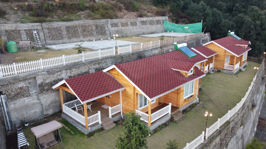
- High-resolution aerial site documentation
- Progress capture for stakeholder reporting
- Geo-referenced imagery packages
- Visual records for construction, risk review, and planning teams
Business Outcomes
- Clearer progress evidence without repeated site shutdowns
- Improved stakeholder updates and remote review
- Reduced need for high-risk manual vantage points
Specialties
Site Progress & Orthomosaic Mapping
High-resolution 2D orthomosaic maps and construction site progress tracking. Delivering geo-referenced geotiff maps and volumetric estimations using photogrammetry.
- High-resolution 2D orthomosaic site map stitching
- Volumetric estimates and distance mapping calculations
- Bi-weekly or monthly construction progress site reports
- Geo-referenced visual data compatible with standard CAD or GIS viewers
Contact Sky Scouts Drones about Site Mapping & Progress